Today I woke up to the sad sight of morning rains. Sad because I hoped for clear skies. Today I would focus entirely on Mt. Mayon (also known as Magayon volcano) — the main reason I came to Legazpi, and quite literally, the region’s biggest attraction.
By the time I stepped out, the rains had reduced to a drizzle and the sun was coming out again
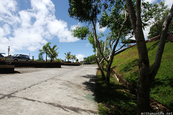
I took two jeepneys (cost me ₱10+₱8) to get to Lignon Hill, which I was told is a great view point to see Mt. Mayon.
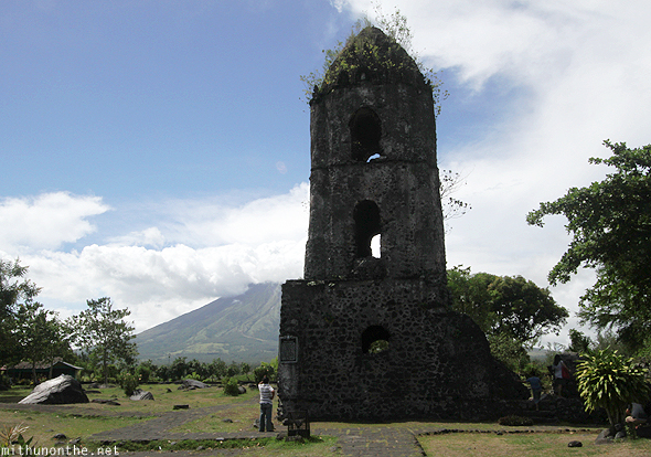
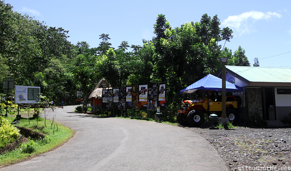
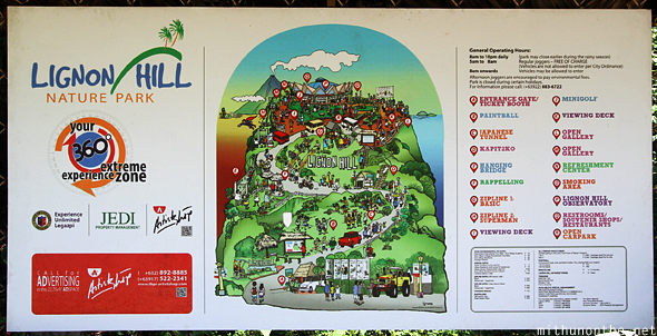
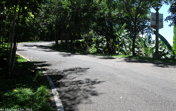
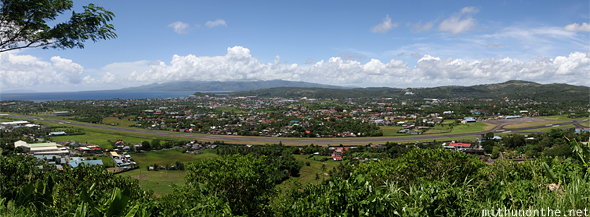
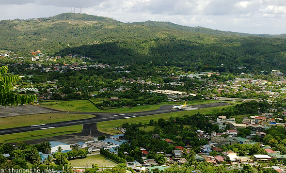
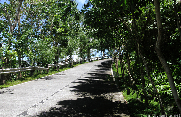
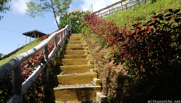
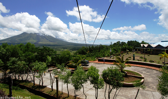
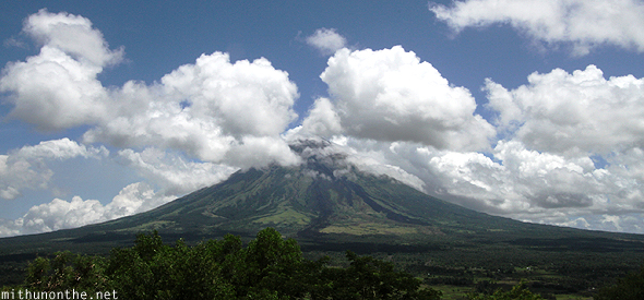
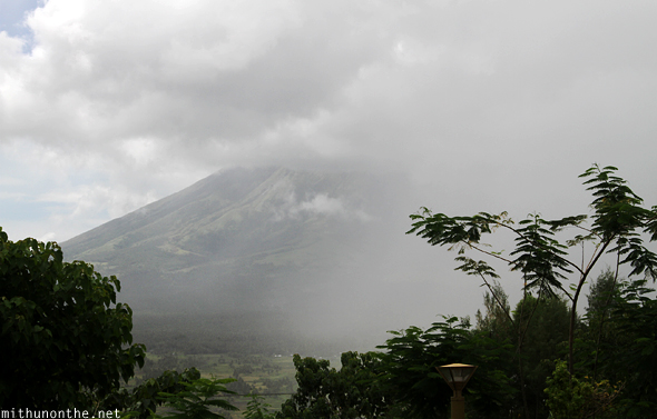
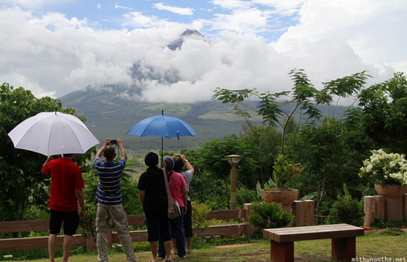
Lignon Hill is a bit out of townThere’s an uphill walk aheadLignon Hill has other attractions, but all I was interested in was getting to the topIf you have a private vehicle, you can ride it uphill as there is parking facility at the topIt did get a bit challenging when the steep stretches began — and that too in this heat!You get a panoramic view of Legazpi airport’s runway from up hereIt’s a great place to see airplanes take off15 minutes later, I sensed I was getting closeAnd I was!Although I was tired of climbing, I felt higher the platform, better the viewThey have a lot of zip lining going on here as wellAs for Mount Mayon… sigh, clouds?
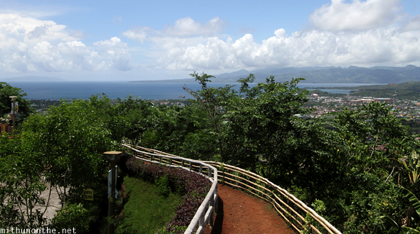
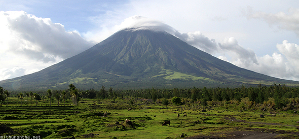
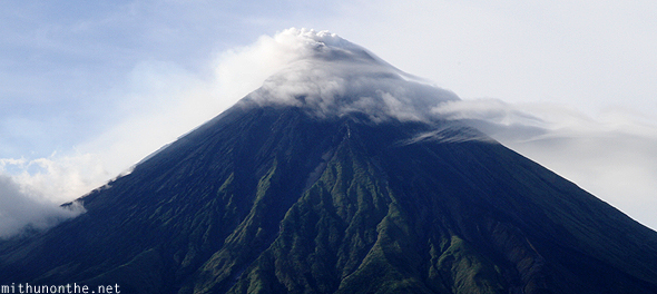
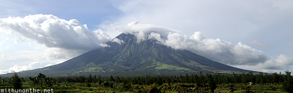
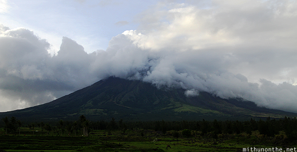
One can see the sea from here tooYou have a few restaurants and souvenir shops up hereI saw a path going downhillI was looking for a spot from where I could get a clear shot of Mount Mayon and the paddy fields belowBut this is the best I could manageIt was frustrating to see the clouds at the tip of the volcano. Mount Mayon is the world’s most perfectly coned volcano — if only I could have photographed it without the damn clouds!
I moved to the car park area for another view.
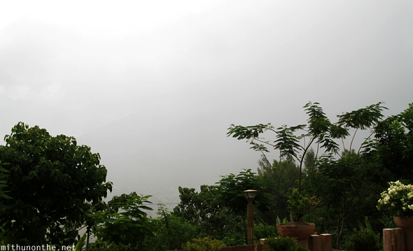
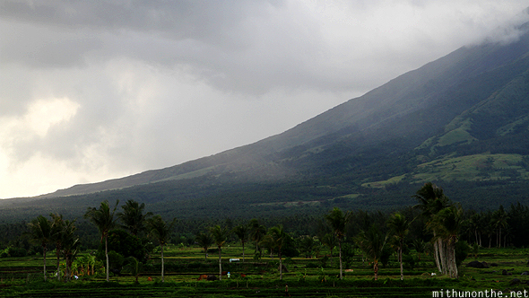
Getting better?Nope, actually it got worseI sat down under the roof because I could see the rain clouds coming our wayNow you see it……now you don’t
I sat there disappointed. After not being able to do the Mt. Pinatubo trek, not getting to see whale sharks in Donsol, I was upset over the thought of another potential disappointment today.
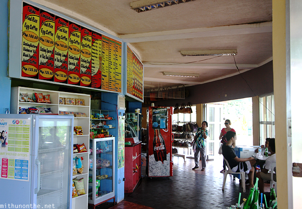
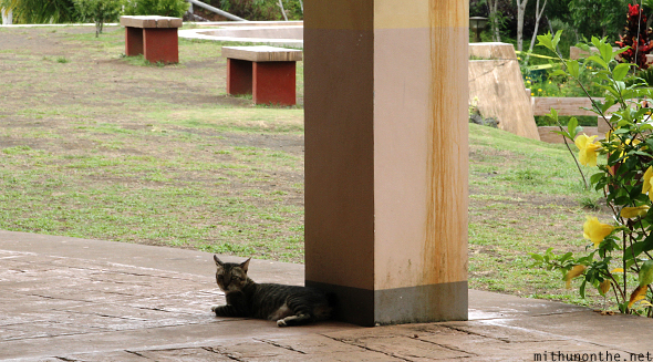
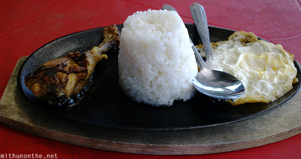
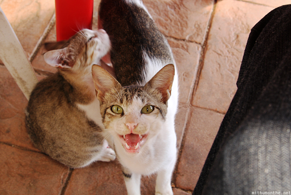
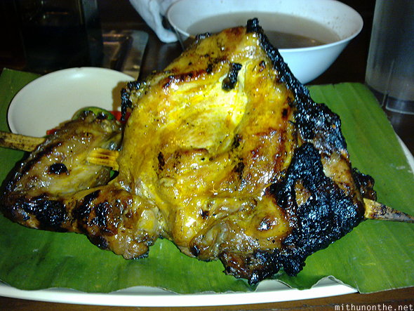
I didn’t want to eat from here as the options were quite slim. But I had no choice, so I ordered a garlic chicken and rice meal (₱120)There were a lot of cats here, and I found them to be quite aggressive. This ass of cat jumped on the table and tried to take a bite out of my chicken leg WHILE I was trying eat. It wouldn’t even wait until I was done! The lack of manners I tell you!Eventually the rains stopped — and it began to clear up again.
I had enough of Lignon Hill and decided to go to Cagsawa Ruins for some better luck.
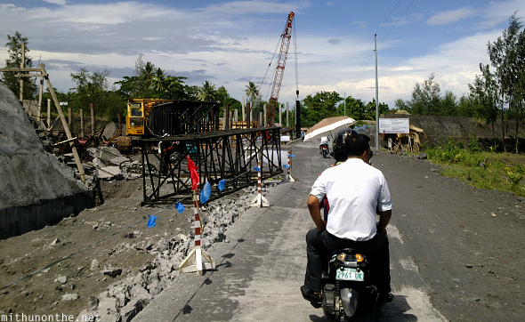
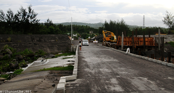
I began walking downhill but a moped taxi driver offered to drop me at Cagsawa Ruins if I paid him ₱100As per the map I was carrying, the site of Cagsawa ruins was no where near walking distance from Lignon HillI hoped the clouds would spare the top of the volcano by the time I reached Cagsawa RuinsThis was some construction going on near the road leading to the Cagsawa Ruins site
I was dropped at the entrance
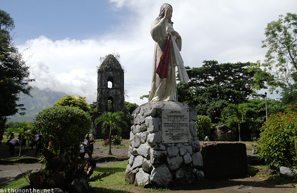
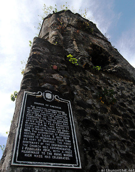
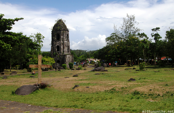
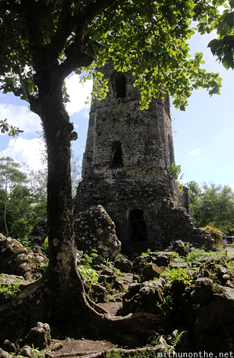
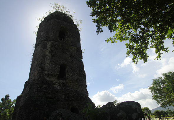
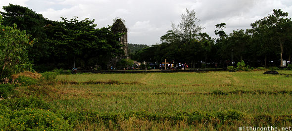
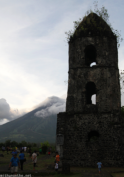
There is an entry fee but it’s quite cheapCagsawa Ruins is a preserved site of what remains of the church that survived the volcanic eruption of Mt. Mayon back in 1814And this is what’s left of the churchThe story of Cagsaua ChurchFrom the sideYou have a few shops inside
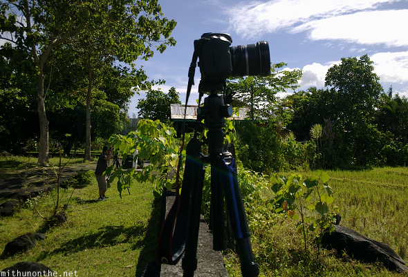
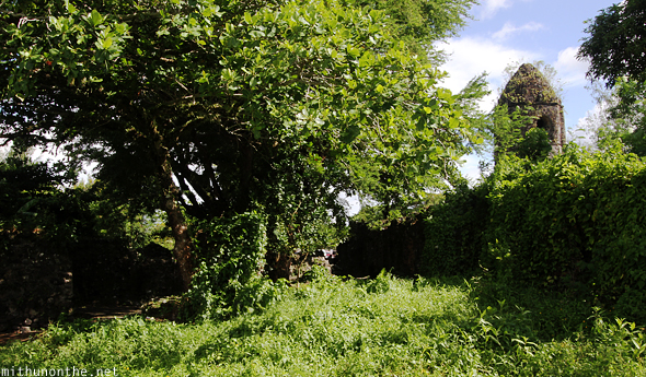
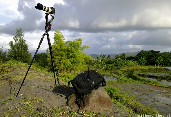
I setup my camera and tripod at the boundary of Cagsawa Ruins, beyond which was a farm. I shot a timelapse sequence from here.I wasn’t the only oneI looked back and wondered if there was any restriction on going any furtherI didn’t see any ‘No Trespassing’ sign anywhereBut I walked back and checked out the other side of the siteThis compound used to house a lot more than just a church
Eventually I mustered up enough courage to just walk past the boundary and entered the fields.
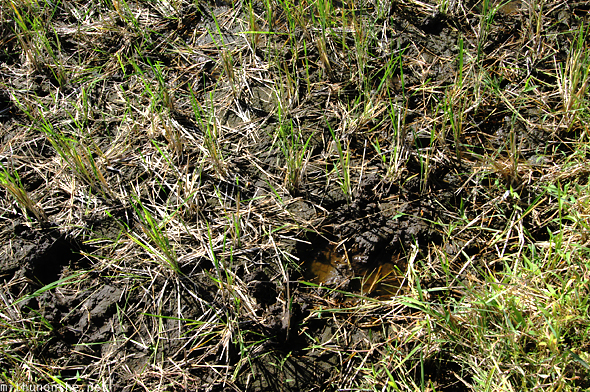
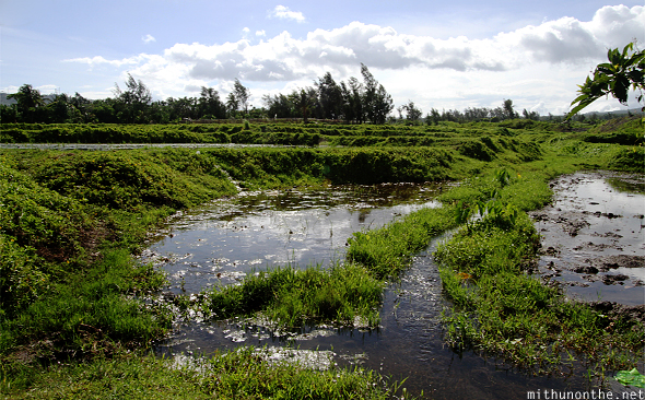
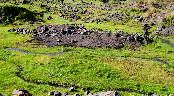
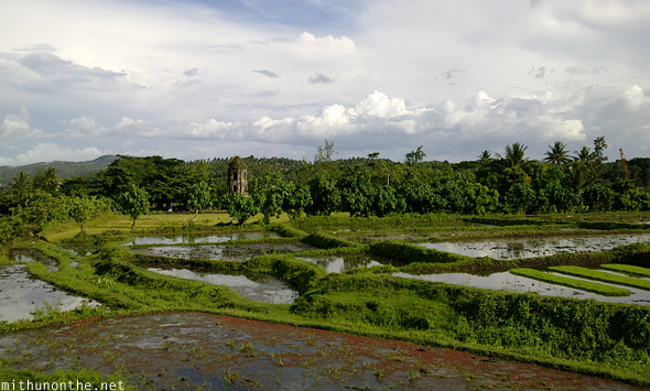
I don’t know who owns these paddy fields. There was no sign claiming private property anyway.I noticed the soil was black, which implied it was very fertile and suitable for agriculture
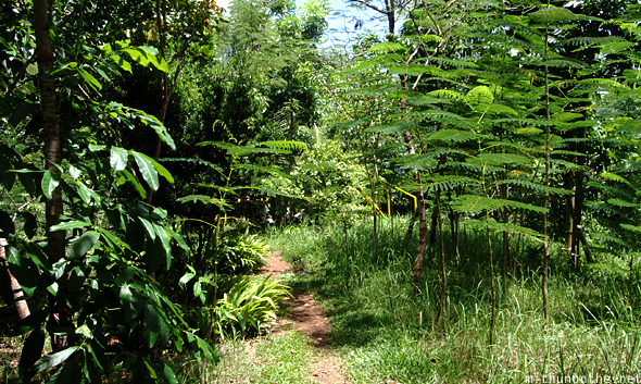
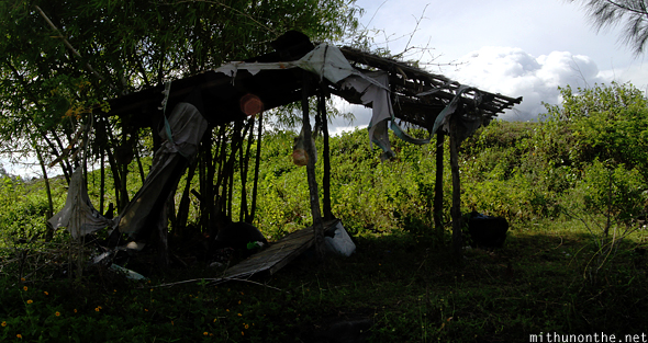
Up ahead I saw a mound and I wondered if the view from there would be even betterI saw what looked like a shed, and I assumed I would find a man somewhere around to ask if it was okay to walk hereBut there was no one to be seen
And so I climbed the mound…
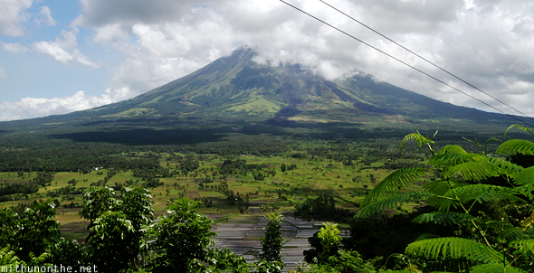
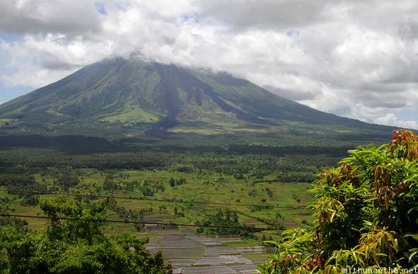
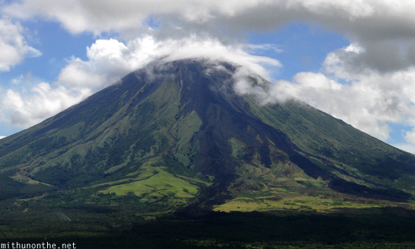
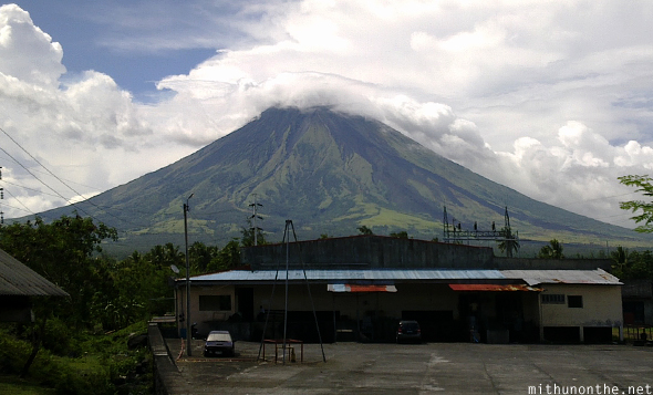
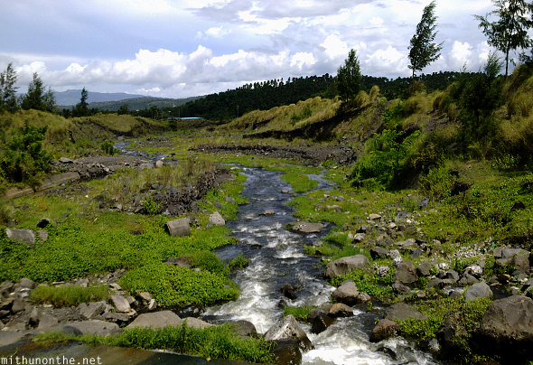
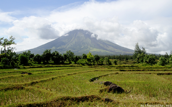
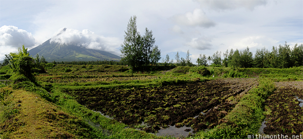
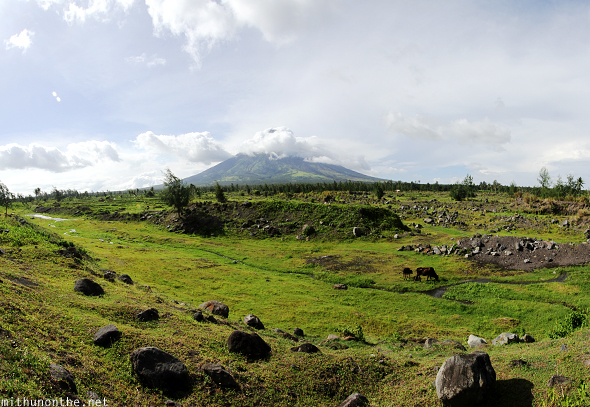
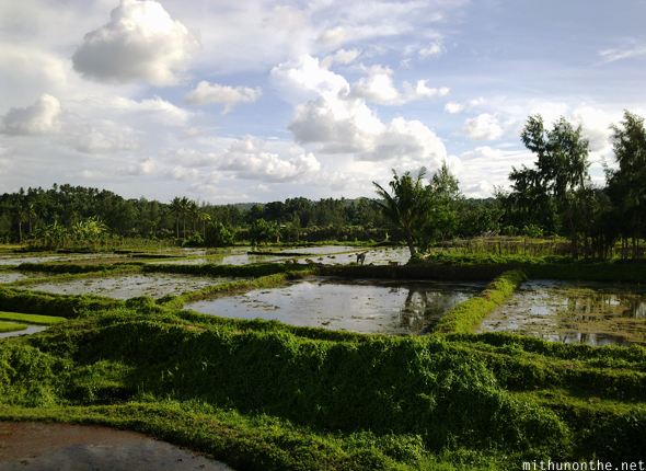
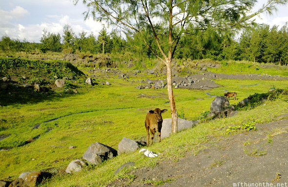
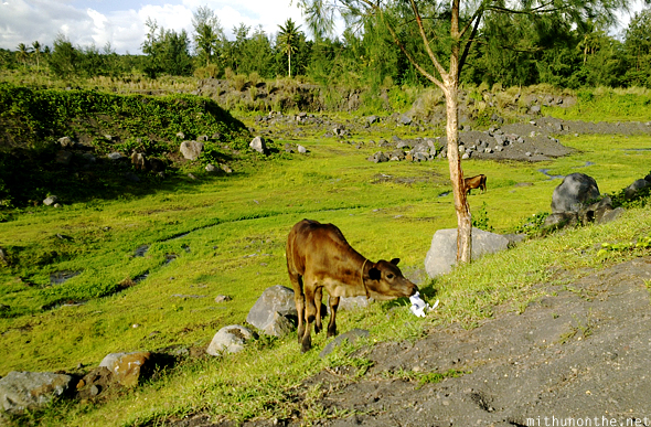
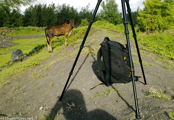
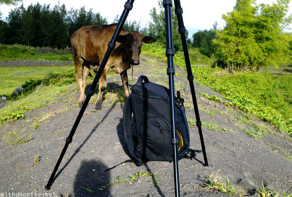
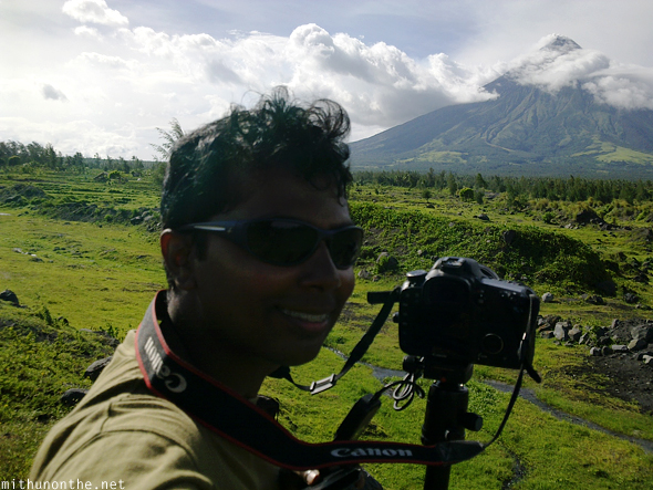
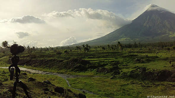
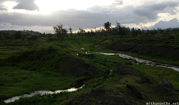
… WOW!It was absolutely beautiful! It felt like I was hundreds of miles away from the nearest town and up some mountain range — but I wasn’t. The grasslands, the grazing cows and the small streams of water just brought a huge smile to my face.I set up my tripod to shoot timelapse sequences hoping the clouds would give the top of the volcano the freedom *I* was seeking!Yes, Mount Mayon is still classified as an active volcano and in fact, it erupted just a few days prior (nothing major though).I used my phone camera to continue clickingThat’s how far away the Cagsawa church wasFinally, spotted one human besides me!The only other company I had were these cowsHe he, poor cow. Trying to eat junk…Wait…Noooo! There’s nothing to eat in my bag, shoo!
Besides shooing away cows, I really felt at ease being here. It was so pleasant, and cool, and beautiful! Green grass, water streams, very few bugs, clean air, no noise and a majestic Mt. Mayon in front of me. Somehow my frustrations just went away.
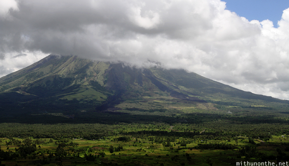
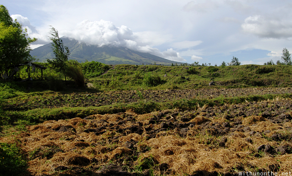
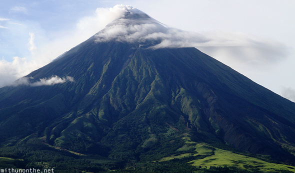
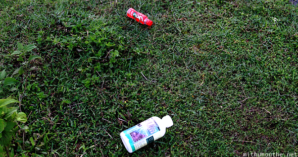
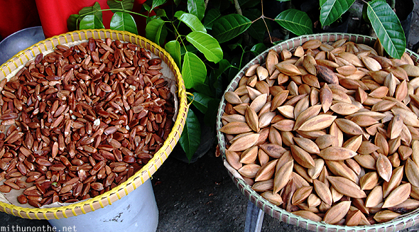
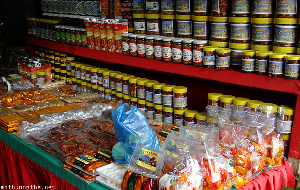
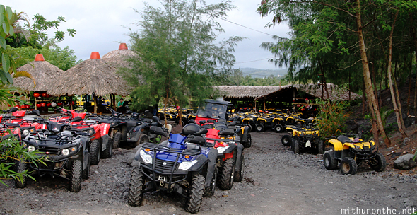
Even though I wasn’t in the best of health, and all alone, I was still happyI swapped lenses and shot timelapses from different angles. It did get windy though.Even though I had spent more than 2 hours just staring at Mount Mayon and it’s surroundings, not once did the clouds completely disappearTo makes things worse, I saw rain clouds making their way from right to leftSo imagine hoping: “Yes, that tiny cloud on the right will clear away soon… right?”And then seeing this insteadThe rains were over in 15-20 minutesEven though there is a 6km wide ‘danger zone’ set in place because of Mt. Mayon’s recent eruptions, there are still houses and people living close to the volcanoAlas, I couldn’t afford to hang around here any longer. It was getting late.The sun was setting. So I packed up and made my way back. I thoroughly enjoyed being here. I considered the greenery and serenity of this place a highlight of this trip.Which is why it annoyed me seeing plastic bottles thrown on the ground. I had to pick them up and dump them at the Cagsawa Ruins trash cans. People, please have some civic sense. Nobody is assigned to do a daily routine of cleaning up of such vast open spaces.Not once did I see any security personnel whistle or wave at me to come back. I was here for more than 2 hours.It was time to say goodbyeOutside, a lot of shops were selling this stuff, pili nuts, which the saleswoman told me was unique to the Bicol region. They are soft nuts (imagine walnuts in crunch) and I sampled a few.You get pili nuts caramelized, plain, coated in chocolate and in many other flavours. I bought a few to take back to India and jar for my friend Janet.On any other day, you could rent these ATVs and go on guided tours around and closer to Mount Mayon. But because of the curfew on going anywhere near the volcano, these tours were temporarily stopped.I walked back to the main road and easily got a jeepney from there
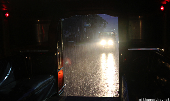
The jeepney did pass by Albay and I could have gotten down. But I figured I’d go and have dinner from the city. That turned out to be a bad idea. I could see grey skies in the distance by around 6pm, but when some of the passengers decided to get out of the jeepney, leaving only me in the back, I took it as a bad sign.
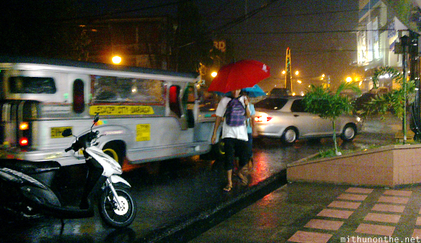
It rained hard!Even though I had an umbrella with me, I took shelter at a 7-Eleven when I got down from the jeepney
After the rains subsided, I walked around Legazpi city because I read online there was a small concentration of Indians who have been in Legazpi for some time.
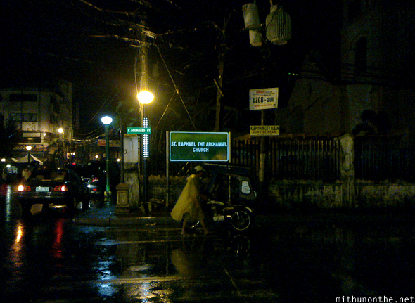
I really didn’t know where exactly in the city center I was or where to go
It was dark, most of the shops were shut or shutting down. I gave up trying to find the area and decided to head back. I bought some meds from a pharmacy, picked up some Dunkin Donuts for tomorrow’s breakfast and took a jeepney back to Albay.
For dinner, I ended up at Mang Inasal again. With the cold rain, I somehow craved the unlimited supply of that hot soup along with chicken and rice. It warmed my feverish body.
Although I was disappointed I couldn’t shoot Mt. Mayon perfectly without the clouds, I still felt calm and at ease today. All thanks to the unspoiled beauty and serenity that I experienced out in the grasslands. It’s no wonder the people of Bicol named the volcano “magayon” — which mean ‘beautiful’ in the local dialect — when it’s not erupting and damaging property that is.
If you want to know what Mt. Mayon looks like without the clouds, see yesterday’s post — and the next. Yup, luck is never on my side when I most need it!
P.S: The timelapse video of Mount Mayon will come a bit later. I shot over 2,000 photos and I haven’t got the resources to make the video yet.
Update: Here’s the video, pieced together in Adobe After Effects with music by my younger brother
Hello Mithun! Your blog, so far, is the most interesting piece ever about Mayon. I felt as if I were in your shoes and looking through your eyes. Maybe I had enough of vain shots here and there. I’m planning to go to Mt. Mayon soon.
hi! Your photos are wonderful, it really captivate and inspire me to visit mt. Mayon and being able to experienced mountaineering activities there and witness it’s natural beauty though sometimes it bring harm and danger in going there.


 I was dropped at the entrance
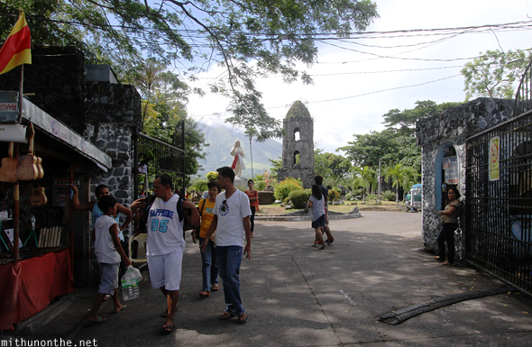


 Eventually I mustered up enough courage to just walk past the boundary and entered the fields.
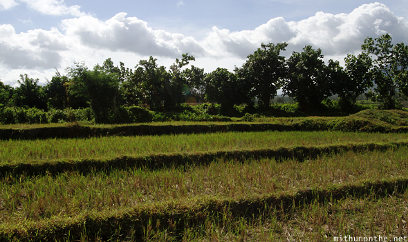


Jill
13/02/2014beautiful pics!
Mithun Divakaran Reply:
February 14th, 2014 at 12:51 AM
Thank you!
Shairmaine
29/02/2016Hello Mithun! Your blog, so far, is the most interesting piece ever about Mayon. I felt as if I were in your shoes and looking through your eyes. Maybe I had enough of vain shots here and there. I’m planning to go to Mt. Mayon soon.
PS you know how to avoid the crowd huh!
Mithun Divakaran Reply:
February 29th, 2016 at 4:32 PM
Thanks for your kind words Shairmaine!
I just walked into the fields away from the crowds. Not many ventured into the fields.
Juliet Mountaineer
10/03/2016hi! Your photos are wonderful, it really captivate and inspire me to visit mt. Mayon and being able to experienced mountaineering activities there and witness it’s natural beauty though sometimes it bring harm and danger in going there.